

The Harbour Business Forum (HBF) has initiated this website as a freely available information resource for everyone who cares about Hong Kong’s Victoria Harbour and wants to know more.
This website complements the heritage of Harbour-related studies carried out by HBF over the past decade and is intended to become a focal point for knowledge and ideas about the Harbour, Hong Kong’s uniquely valuable asset, and all of its various uses as a vital contribution to the quality of life in Hong Kong.
This website forms an important part of HBF’s most recent study into the importance of integrated land-water planning around Victoria Harbour. This study builds on HBF’s Integrated Harbour Vision and Delivery Plan – The Business Case (2009) to make the case that planning around Victoria Harbour cannot focus on land-side issues alone but needs to consider use of the water as well. As well as the Land-Water Planning Report, this study has also captured valuable baseline information about the Harbour in two complementary databases as follows:- A comprehensive spreadsheet database of existing and future land-uses and marine interfaces along the entire waterfront of Victoria Harbour
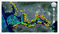
- An interactive map of Victoria Harbour that shows graphically the locations of water and land-uses around the harbour, built on “Google Earth” software that is available free to download.
These databases mark the first ever attempt to gather all this information together into a single location. With this website, HBF is making both of these databases freely available for public use and benefit.